


Asen’s Fortress / Bachkovo monastery
Tour schedule:
From 30 EUR
Price for Adult: 35 EUR with VAT.
Price for Child (3-12): 25 EUR with VAT.
Price for Senior/Student: 30 EUR with VAT.
Price for Group over 4 people: 30 EUR with VAT.
Tour Details
Upon request. The tour could be tailor made or Privately design.
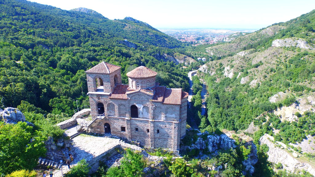
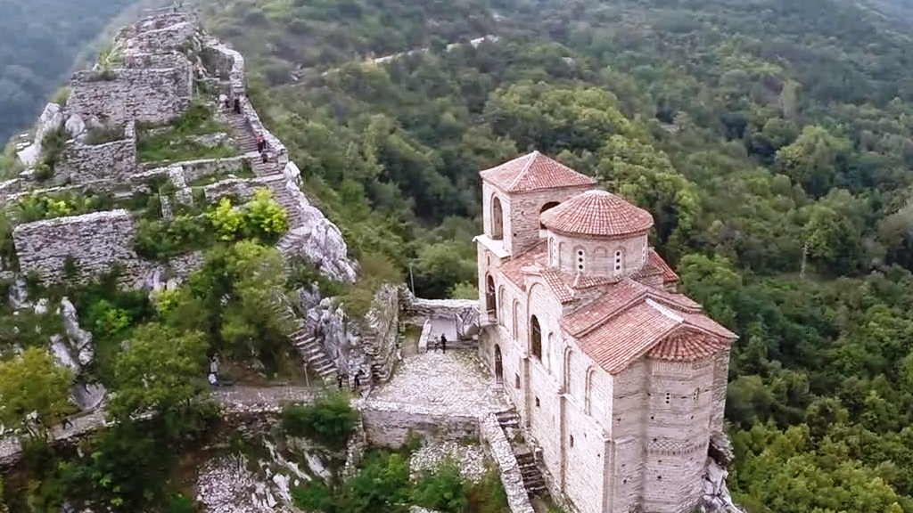
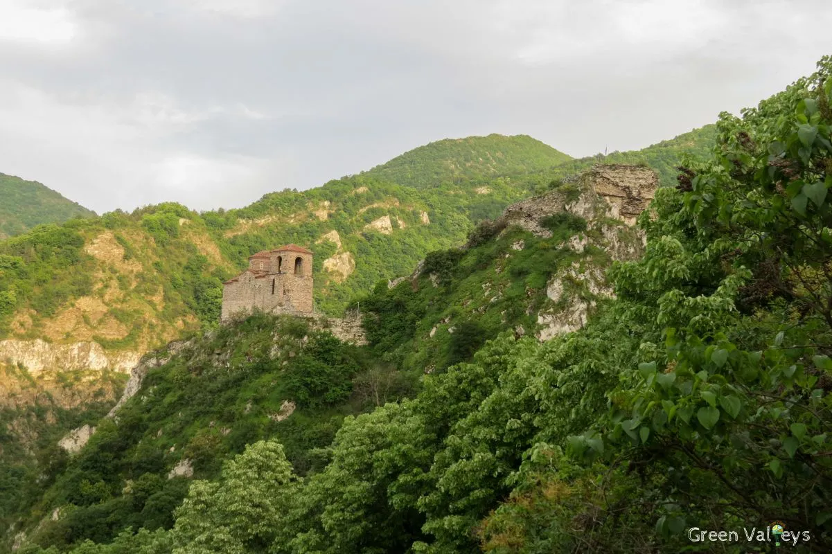
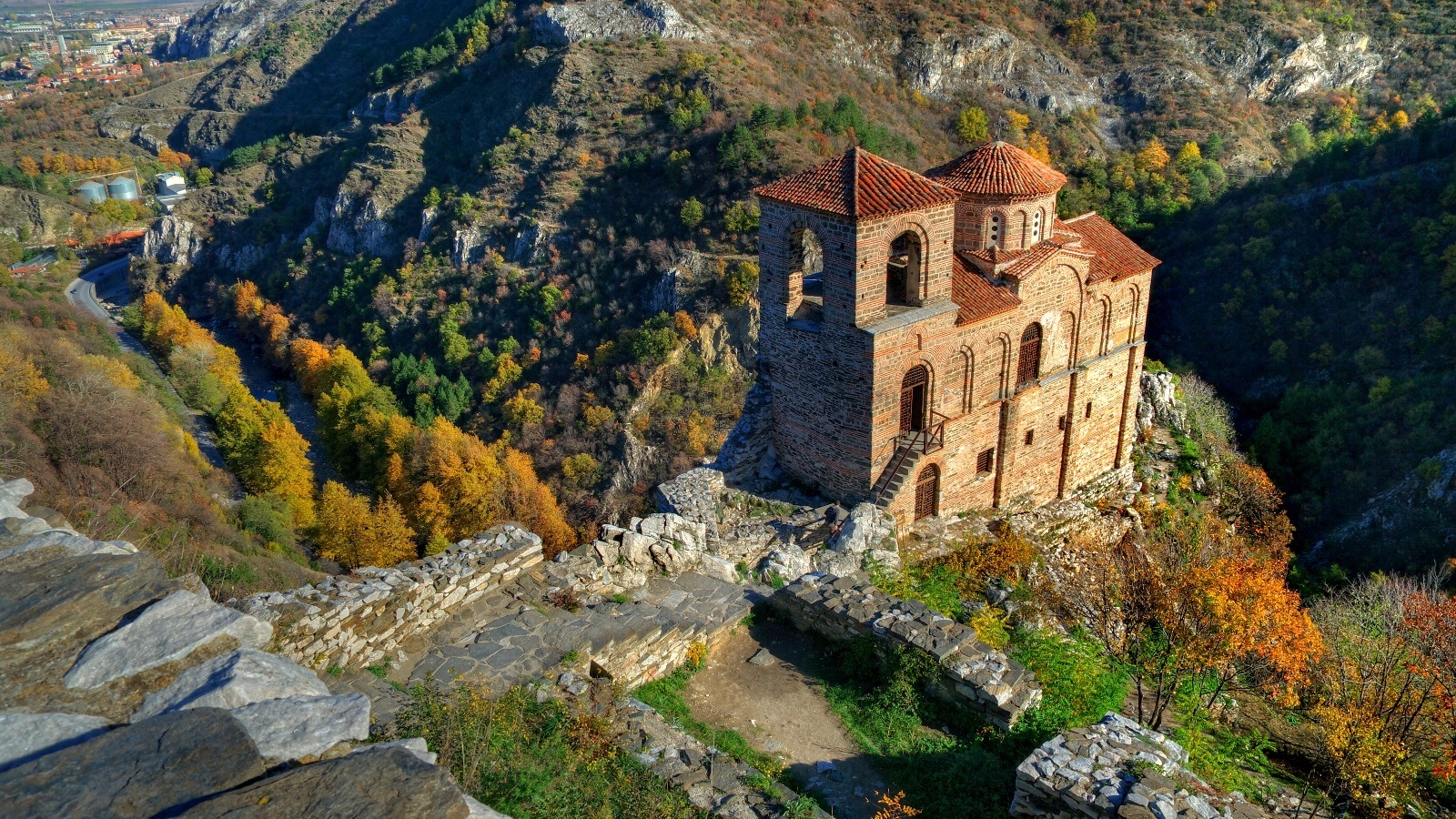
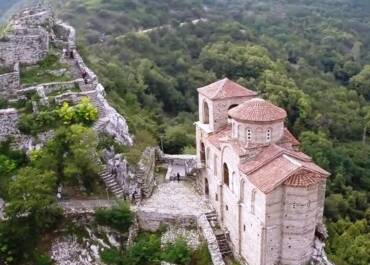
Asen’s Fortress – The Church of the Holy Mother of God is located of near Asenovgrad. Bulgarian’s fortress belongs to one of the Bulgaria’s most famous kings, Ivan Asen II. It is still in regular use as a Bulgarian Orthodox church.
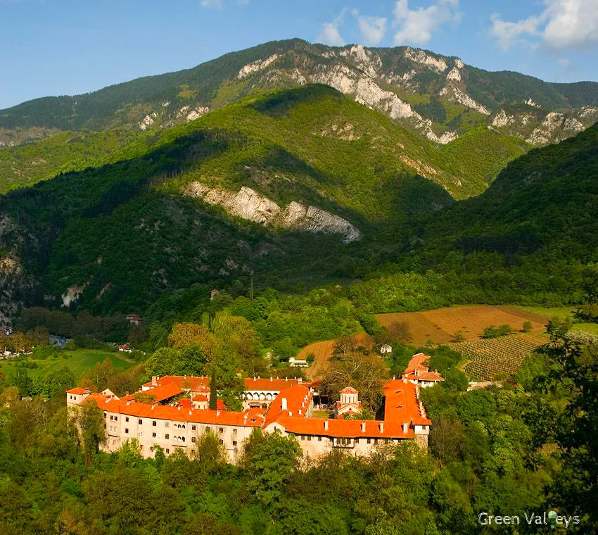
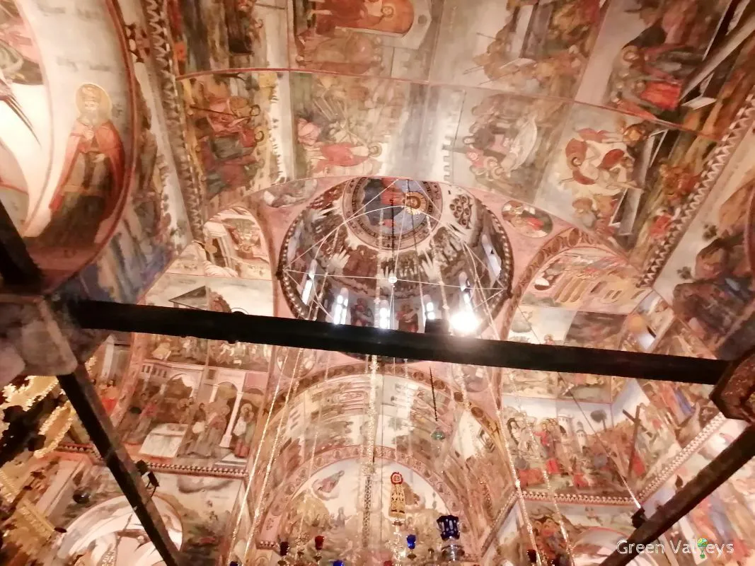
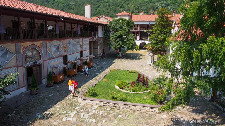
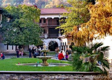
Bachkovo Monastery “Assumption of the Virgin” is located in the southern part of the village Bachkovo.
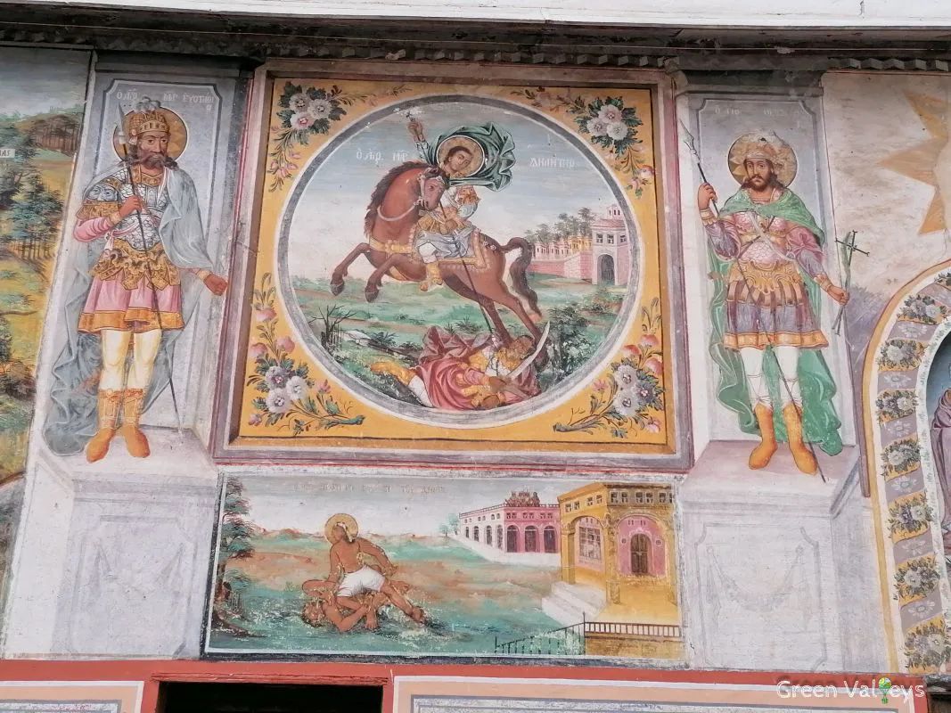
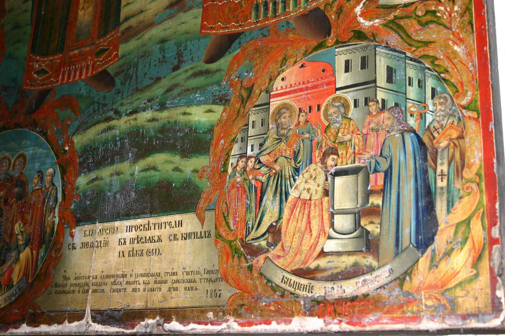
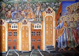
In fact you will explorer famous Bulgarian icon painter Zahariy Zograf (1810-1853). Also executed the images in the church’s interior from 1838-1840, and in 1841 he completed the frescoes on the exterior of The Holy Archangels Church.
Highlights:
∗ Our team will be waiting to greet you at the parking in front of the Hotel Ramada (Trimoncium Hotel Plovdiv) http://!!!Green Valleys meeting point Plovdiv. google/maps!!! or you can arrange your pick up point in advance with member of our booking team.
∗ Explore the ancient Asen’s Fortress, controlled by the Thracians, Romans, Byzantines, Crusaders,Ottomans and Bulgarians, our professional storytelling guide has so much to share with you.
∗ Learn about the history of Bulgarian culture by vising the Bachkovo Monastery “Assumption of the Virgin” – Fantastic place.
∗ Lunch in a thematic country restaurant, relax at the charming atmosphere, while being served delicious cooked food.
∗ Enjoyable afternoon in the Marvelous Bridges.
∗ Boarding the coach and departing back to the town of Plovdiv.
In case of medical issues or allergies you should always consult your tour representative if you are not sure of what ingredients a dish contains.
Places You’ll See

Tour Itinerary:
Day Tour
∗ 09:00: Tour starts from the parking in front of Hotel Ramada (Trimoncium Hotel Plovdiv) you will be picked up from the place, if arranged with member of our booking team in advance. The trip to Asen’s fortress lasts about two and a half hours through beautiful countryside.
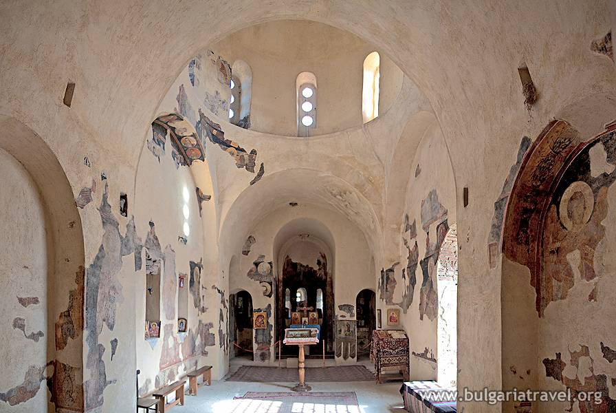
∗ 15:00 – 16:00: Walk around the ancient Asen’s Fortress, a medieval fortress in the Rhodope Mountains controlled by the Thracians, Romans, Byzantines, Crusaders, Ottomans and Bulgarians. Asen’s Fortress is also the most notable examples of Medieval Christian architecture with frescoes dating back to the 13th century. The church is one of the oldest in all of Eastern Orthodoxy and has a tower once used as a belfry and watchtower.
∗ 12:00 – 13:00: Visit to the Bachkovo Monastery of the Dormition of the Theotokos, where you will learn about the Bulgarian history. You will learn about the creativity of Zahary Zograf (1810-1853), a famous Bulgarian painter of the Bulgarian National Revival, noted for his church mural paintings and icons and often regarded as the founder of secular art in Bulgaria due to the introduction of everyday life elements in his work.
∗ 13:30 – 14:30: Lunch in a thematic country restaurant, relax at the charming atmosphere while being served delicious cooked food.
∗ 14:30 – 14:45: Boarding the couch and departing towards the Marvelous Bridges.
∗ 15:00 – 16:00: Enjoyable afternoon in the Marvelous Bridges- The “bridges” were formed by the erosive activity of the once larger Erkyupryia River. It transformed the marble clefts into a deep-water cave, the ceiling of which eroded through time and collapsed, possibly during an earthquake.
∗ 17:00: Boarding the coach and head back to Plovdiv.
∗ 19:00: Expected time of arrival in Plovdiv at the parking in front of Hotel Ramada (Trimoncium Hotel Plovdiv) or at your preferable location if requested in advance at the time of booking.
We miss you already – Hope that will see you again.
See you.
Pick up/ Drop off points:
Our team will be waiting to greet you at the parking in front of Hotel Ramada (Trimoncium Hotel Plovdiv), http://!!!Green Valleys meeting point Plovdiv. google/maps!!!, or you can arranged your Pick up point in advance with member of our booking team.
Please arrive 15 minutes before your scheduled departure time for boarding.
Asens Fortress
Asen’s Fortress is The Church of the Holy Mother of God of Asenovata Krepost near Asenovgrad, Bulgaria a fortress of one of Bulgaria’s most famous kings, Ivan Asen II. It is still in regular use as a Bulgarian Orthodox church.
Take a journey to the Asens Fortress controlled by Thracian,Romans,Byzantines,Crusaders,Ottomans and Bulgarians.
With drops that are almost vertical and at times even overhanging above the river below, it is impregnable on three sides. Its strategic location and natural defenses explain why it has been used since the days of the Thracian, who fortified it in the 5th century BCE.
Asen Fortress is also the most notable examples of Medieval Christian architecture with frescoes dating to the 13th century. The church is one of the oldest in all of Eastern Orthodoxy, and has a tower once used as a belfry and watchtower. Our professional storytelling guide has so much to share with you.
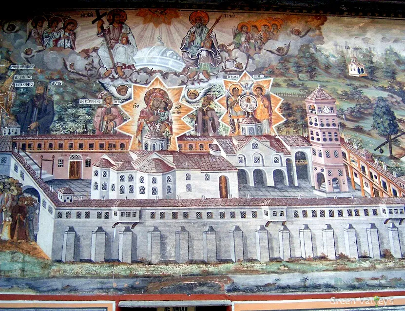
The Bachkovo Monastery “Assumption of the Virgin”
You will discover famous Bulgarian icon painter Zahariy Zograf (1810-1853), executed the images in the church’s interior from 1838-1840, and in 1841 he completed the frescoes on the exterior of The Holy Archangels Church.
In the cathedral there is an icon from 1311 known as The Holy Mother of God Icon, with a silver repousse cover. This icon is believed to have miraculous powers.
Visitors to monastery may also view other icons, silver repousse covers for copies of the Gospels, and other works of art from the 16th to the 19th centuries.
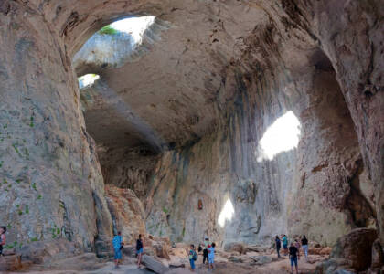
Marvelous Bridges
The “bridges” were formed by the result of erosive activity of the once larger Erkyupryia River. Two bridge-shaped outcrops remained. The larger one (upstream) is 15 metres at its widest and 96 metres long, and shaped by three vaulted arches, the largest of which is 45 metres high and 40 metres wide. The river flows under the middle-sized arch. The larger Wonderful Bridge is passable under the vaults, where birds nest in the marble clefts. The smaller bridge is 200 metres downstream. It is impassable to tourists, 60 metres in length, with a total height of 50 metres, 30 metres at the highest point of the arch. A third, small and inaccessible, formation follows, the entrance to a pothole where the river’s waters disappear underground, reaching a sump after 3 km.
The adjacent area is wooded, with century-old conifers, mainly spruces. Many karst caves are known nearby, but most of them are undeveloped and unsuitable for tourist visits. However, both bridges can be crossed on secure trails. Two tourist huts are located nearby. The site can be reached by an asphalt road and is about 30 km from the closest town, Chepelare.
Food:
Our guests can choose between different diet menu, including vegetarian, Jain or non-vegetarian meals (Halal will not always be available).
Guests should advise the tour representative of their preferred diet on day one. You should always consult a member of our staff if you have any alergy to the ingredients of the dishes or you not sure of what ingredients a dish contains.
Why to choose us:
(pre arrangement required)
(pre arrangement required)
Asen’s Fortress / Bachkovo monastery
Tour schedule:
From 30 EUR
Price for Adult: 35 EUR with VAT,
Price for Child (3-12): 25 EUR with VAT.
Price for Senior/Student: 30 EUR with VAT.
Price for Group over 4 people: 30 EUR with VAT.
Price included:
∗ The excursion is Upon request.
∗ Returning transport will be by coach from pick up point and drop off point.
∗ Visit to the Asen’s Fortress.
∗ Visit to the Bachkovo Monastery.
∗ Professional local guide included.
Price excluded:
∗ Entrance fee for all museums and attractions.
∗ Personal expenses.